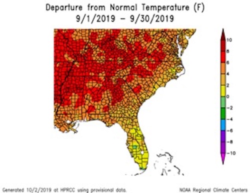
While it seems Georgia is finally seeing a break from the summer heat, the long hot summer, including a record-setting September, has already caused problems for many Georgia farmers.
With almost no rain during September, drought conditions expanded across the state.
Record-setting temperatures and almost no rain during September caused a major expansion of drought across Georgia. The dry conditions caused problems for farmers trying to grow forage and harvest peanuts in heavier soils but the harvest was ahead of schedule due to the lack of rain.
At the beginning of the month, only 7 % of the state's area was in moderate drought and 27 % was abnormally dry or in drought. By the end of the month, the entire state was at least abnormally dry, and extreme drought covered over 4 % of the state, mostly in areas north and south of the Atlanta metro area.
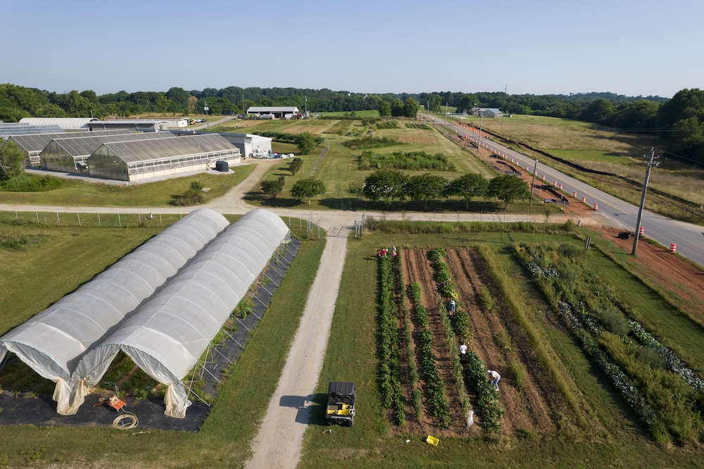
The dry conditions in September caused a lot of problems for farmers. Forage stopped growing and feeding hay to livestock was widespread. Filling of soybean pods was reduced with a negative impact on yields, and it was too dry to defoliate some cotton and harvest some dryland peanuts. However, in areas where harvest was possible, dry and clear weather allowed harvests to proceed ahead of schedule for both cotton and peanuts.
While October saw a break from record high heat across the state, climatologists project that temperatures will continue to be warmer than normal throughout fall. The state should see less rainfall than normal during October but may return to normal patterns later this fall.
A return to normal would be welcome after such a dry summer and September when the majority of the state receiving less than a quarter of their normal monthly rainfall.
The highest monthly total precipitation recorded by the National Weather Service reporting stations was 2.76 inches in Brunswick, 3 inches below normal. The lowest temperatures were in Macon and Valdosta, with 0.02 inches each, 3.57 inches below normal for Macon and 4.62 inches below normal for Valdosta.
- Albany received 1.27 inches; 2.17 inches below normal
- Alma received .2 inches; 3.44 inches below normal
- Atlanta received .76 inches; 3.71 inches below normal
- Athens received 1.4 inches; 2.54 inches below normal
- Augusta received .77 inches; 2.45 inches below normal
- Columbus received 1.29 inches; 1.77 inches below normal
- Rome received 0.31 inches; 3.10 inches below normal
- Savannah received 1.27 inches; 3.31 inches below normal
Not surprisingly, no daily precipitation records were set during the month.
The highest 24-hour rainfall total from Community Collaborative Rain, Hail and Snow Network observers in September was 4.50 inches observed east of Newnan in Coweta County on Sept. 29, followed by 4.45 inches measured south of Savannah in Chatham County on Sept. 18 from Humberto. The highest monthly amount was 6.51 inches measured by the observer south of Savannah in Chatham County, followed by 6.32 inches measured near Darien in McIntosh County.
While rainfall was far below normal, temperatures were above normal across the state.
- In Albany, the monthly average temperature was 82.9 F, 5.2 degrees above normal.
- In Alma, the monthly average temperature was 79.7 F, 2.6 degrees above normal.
- In Athens, the monthly average temperature was 79.3 degrees F, 6.0 degrees above normal.
- In Atlanta, the monthly average temperature was 82.4 degrees Fahrenheit, 8.9 degrees above normal.
- In Augusta, the monthly average temperature was 80.2 F, 5.6 degrees above normal.
- In Brunswick, the monthly average temperature was 82.5 F, 4.4 degrees above normal.
- In Columbus, the monthly average temperature was 83.3 F, 6.7 degrees above normal.
- In Macon, the monthly average temperature was 81.1 F, 6.1 degrees above normal.
- In Rome, the monthly average temperature was 80.0 F, 6 degrees above normal.
- In Savannah, the monthly average temperature was 81.4 F, 4.4 degrees above normal.
- In Valdosta, the monthly average temperature was 81.5 F, 4.1 degrees above normal.
Numerous high-temperature records were broken during the month, especially in the last week.
Some of the daily records include: 99 F in Atlanta on Sept. 12 (breaking the old record of 94 F set in 1900), 97 F in Athens on Sept. 27 (breaking the old record of 94 F set in 1954 - another drought year), 100 F in Columbus on Sept. 26 (passing the old record of 99 F set in 1921), 103 F set in Macon on Sept. 17 (breaking the old record of 98 F set in 2018), and 101 F set in Augusta on Sept. 30 (surpassing the old record of 96 F set in 1904).
Many other high-temperature records were broken or tied this month, including Brunswick which reported a new high nighttime low temperature of 79 F on Sept. 27 (breaking the old record of 76 F set in 1998).
For more information, see the “Climate and Agriculture” blog at https://site.extension.uga.edu/climate/ or follow SEAgClimate on Facebook and @SE_AgClimate on Twitter. Email your weather and climate impacts on agriculture to be shared on the blog to pknox@uga.edu.


