With a record-setting cold snap and snow-snarled highways in north Georgia, January 2014 went into the record books as one bone-chilling month.
After record-setting cold at the beginning of the month, many Georgia cities saw average temperatures between 3 and 8 degrees below normal.
A large ridge of high pressure over California and a deep trough of low pressure over the eastern U.S. allowed frigid Arctic air to reach the Deep South in January, with accompanying new low temperature records and snow in some areas.
On Jan. 7, Atlanta, Athens, Columbus, Macon, Savannah and Augusta all broke their record low temperatures with values ranging from 6 F in Atlanta to 19 F in Savannah. The new records were 3 to 5 degrees lower than their previous record low temperatures for the date, most of which occurred in 1970. Athens, Columbus, Macon, Savannah, Alma and Brunswick also set record low maximum temperatures that day, warming up to only the upper 20s and low 30s after their cold morning starts.
Additional records for cold weather were set in Macon and Brunswick. Many schools closed due to dangerously low wind chills to protect school children who would be waiting at bus stops. The record-setting temperatures also led to rolling power outages in Athens on Jan. 7 due to extremely high demand for electric heating.
A second round of extreme low temperature records were set late in the month in Columbus, Macon, Augusta, Alma and Brunswick when daily maximum temperatures again only rose to the upper 20s to middle 30s during the day on Jan. 29.
The extreme cold snaps helped drive down monthly average temperatures. In Atlanta, the monthly average temperature for January 2014 was 37.0 degrees F (6.3 degrees below normal), in Athens it was 37.0 degrees (6.5 degrees below normal), Columbus averaged 39.7 degrees (7.5 degrees below normal), Macon had 39.1 degrees (7.2 degrees below normal), Savannah was 46.4 degrees (3.1 degrees below normal), Brunswick had 47.6 degrees (3.9 degrees below normal), Alma averaged 45.3 degrees (5.4 degrees below normal) and Augusta was 39.5 degrees (5.9 degrees below normal).
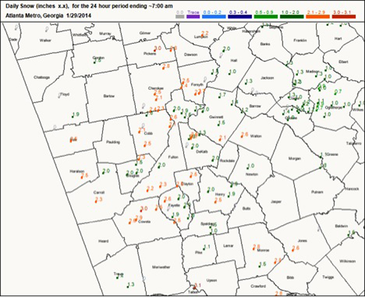
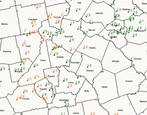
Atlanta, Macon and Columbus reported record high snowfall for the day on Jan. 28 with 2.6 inches in Atlanta, 2.1 inches in Macon and 1.2 inches in Columbus, surpassing the old daily records of a trace set in 2005 at all locations. Snowfall in Metro Atlanta was generally 2 to 3 inches while the Athens vicinity received 1 to 2 inches.
The highest daily snowfall amount reported by volunteer Community Collaborative Rain, Hail and Snow network observers was 3.2 inches in Peachtree City in Fayette County on Jan. 29. The highest monthly snowfall total was 3.8 inches west of Blue Ridge in Fannin County.
Roads in the northeast mountains were closed on Jan. 21 due to snow and high winds at higher elevations. A teenage boy died after he and some friends fell through a frozen pond on Jan. 30 in Calhoun.
The most widespread impact of January’s winter weather was the traffic gridlock in Atlanta on Jan. 28. School and government officials abruptly closed schools and businesses when the snow started falling later that morning. The icy conditions, combined with several million vehicles entering the road system in a short time period, quickly led to a complete traffic standstill.
The Governor announced plans to convene two committees to identify why the existing system failed and to help guide future decisions on weather-related school and business closings. A National Weather Service report on the storm can be found http://www.srh.noaa.gov/ffc/?n=20140128winterstorm.
January was colder than normal, but at least it wasn’t soggy
The highest monthly total precipitation for January from NWS reporting stations was 4.68 inches in Athens (.63 of an inch above normal). The lowest was in Alma at 1.61 inches (2.65 inches below normal). Atlanta received 3.35 inches (.85 of an inch below normal), Macon received 3.23 inches (1.01 below normal), Savannah received 2.41 inches (1.28 inches below normal), Augusta received 2.48 inches (1.43 inches below normal), Columbus received 2.91 inches (.94 of an inch below normal) and Brunswick received 4.59 inches (1.37 inches above normal).
The highest single-day rainfall from a Community, Collaborative Rain, Hail and Snow Network observer was 3.18 inches near Comer in Madison County on Jan.11. An observer near Danielsville, also in Madison County, reported 3.05 inches on the same date. The highest monthly total rainfall was 7.69 inches, observed east of Darien in McIntosh County, followed by 6.06 inches measured near Thomson in McDuffie County.
Severe weather was observed on Jan. 10 and 11, including a weak EF0 tornado that caused isolated damage near Waleska in Cherokee County on Jan. 11. The tornado formed in a line of strong thunderstorms that caused wind damage, downed trees and power lines and localized street flooding across northern Georgia.
The “roller coaster” winter weather conditions are expected to continue for the rest of the season due to the absence of El Nino or La Nina conditions in the eastern Pacific Ocean. Neutral conditions are expected to continue through at least August. Gardeners should note that in neutral winters and springs the chance of a late frost, while still rare, is more likely than years with either El Nino or La Nina conditions present.


