Extreme drought conditions now cover most of Georgia south of the mountains. Extreme drought is the next-to-highest drought category. All counties in Georgia are now classified as being in moderate, severe or extreme drought.
All counties south of Carroll, Douglas, south Fulton, Clayton, Henry, Rockdale, Walton, eastern Barrow, eastern Jackson, Madison and Elbert counties, inclusive, are now classified in extreme drought.
Across north Georgia, the counties of Dade, Fannin, Union, Towns, Rabun, Gilmer Lumpkin, White, Habersham, Pickens, Dawson Hall, Forsyth, north Fulton and north Gwinnett are classified in moderate drought. Moderate drought is the lowest drought category.
The remaining counties in north Georgia are classified as being in severe drought.
Soil moisture levels in extreme drought counties are between the first and fifth percentile. At the first percentile the soils in late August would have more moisture 99 out of 100 years. At the fifth percentile the soils would have more moisture 95 out of 100 years.
Streams flow slow
Stream flows are extremely low across Georgia.
In north Georgia, U.S. Geological Survey stream gauges are reporting daily record-low flows at the:
- Chattooga River near Clayton (record set in 2000).
- Chattahoochee River near Leaf (record set in 1957) and Cornelia (record set in 2007).
- Cartecay River near Ellijay (record set 1953).
- Coosawattee River near Pine Chapel (record set 1977).
- Etowah River near Canton (record set 2002).
- Sweetwater Creek near Austell (record set 2002).
- Oconee River near Athens (record set 1987) and near Penfield (record set 1987).
- Apalachee River near Bostwick (record set 1981).
- Broad River near Bell (record set1988).
- Cedar Creek near Cedartown (record set 2007).
- Murder Creek near Eatonton (record set 2007).
- Flint River near Griffin (record set 1993).
Across south Georgia, USGS stream gauges report daily record-low flows at the:
- Oconee River near Dublin (record set 2002).
- Turkey Creek at Byromville (record set 2001).
- Upatoi Creek near Columbus (record set 1987).
- Muckalee Creek near Leesburg (record set 2000).
- Pachila Creek near Edison (record set 2000).
- Flint River at Albany (record set 2000) and near Newton (record set 2000).
- Little River near Adel (record set 2002).
- Ohoope River near Reidsville (record set 1980).
- Ocmulgee River at Lumber City (record set 2000).
- Altamaha River near Baxley (record set 2000).
- Doctortown (record set 2000).
- Satilla River near Atkinson (record set 1990),
The Ogeechee River near Eden is at an all-time, record-low flow of 57 cubic feet per second.
The North Prong, part of the St. Mary’s River in extreme south Georgia near Moniac, has stopped flowing. So have the Okapilco Creek near Quitman and Spring Creek near Iron City.
Groundwater levels in the coastal plain are at or near record-low levels for all long-term USGS monitoring wells. Record low monthly groundwater levels were reported in the Upper Floridian Aquifer at Mitchell, Lauren and Toombs counties and the Clayton Formation in Randolph County.
Major reservoirs on the Chattahoochee, the Savannah and the Etowah rivers are dropping. The Chattahoochee River reservoirs, Lakes Lanier, West Point and Walter F. George are entering Zone 3. The Savannah River reservoirs, Lakes Hartwell and Clarks Hill are entering level two. Lake Allatoona on the Etowah River is currently in Zone 1.
Wildfire risk rises
Recent weeks have seen wildfire activity well above normal across the state. The Georgia Forestry Commission rates the wildfire danger from high to extreme. Since Aug. 1, more than 2,230 acres have been scorched in the state. This is double the long-term August average.
GFC reports that since Jan. 1, more than 448,600 acres have been scorched by wildfires. Increased wildfire risk remains. Precaution must be exercised when doing any activity that could generate sparks. Preventable sources of wildfires include backyard grills, campfires and cigarettes, and also over-heated lawn equipment, farm equipment and electrical lines.
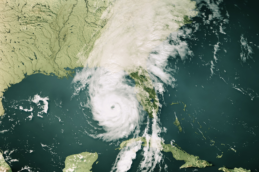
The outlook for near-term drought relief is not promising. Unless Georgia gets some tropical weather over the next few months, the state can expect below-normal rainfall and above-normal temperatures. Without some tropical rains, soils are expected to dry out. Stream, groundwater levels and reservoir levels are expected to continue to drop. Wildfire potentials are expected to remain high to extreme.
Over the next three to nine months, drought conditions may persist. Computer models and historical climate analysis indicate the return of the La Niña ocean-atmosphere pattern. Typically a La Niña winter and spring means below-normal rainfall and above-normal temperatures. While a typical La Niña winter is very nice in Georgia, it also means that the much needed moisture recharge during the winter and spring will not typically be large enough to get the state through the next summer without drought conditions continuing.
Up-to-date information on dry conditions across the state can be found at www.georgiadrought.org. Updated weather conditions can be found at www.georgiaweather.net.


