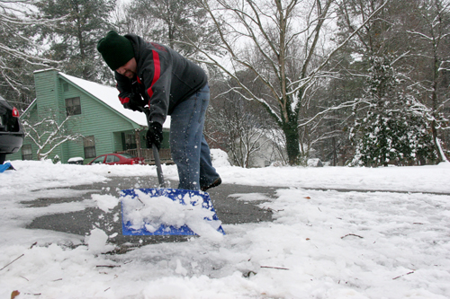
A strong winter storm will throw a double punch of extreme conditions across northeast Georgia this week - Tuesday through Thursday.
The first part of the storm is expected to move into northern Georgia Monday night and Tuesday morning with the potential for sleet, freezing rain and snow up to several inches in the higher elevations. The second, stronger part of the storm will move in around Tuesday evening and is expected to bring widespread freezing rain to most of northern and eastern Georgia.
Accumulations of a half-inch or more could be seen in some areas of the state. Freezing rain accumulation of a quarter inch can cause power outages.
Impacts from the double-barrel storm are expected to be severe. Snow early in the period may make roads in some areas slippery and difficult to navigate. Freezing rain later in the storm could lead to widespread damage to power lines. Trees may be weakened after suffering from years of drought and may suffer broken limbs due to ice accumulation. Areas that receive the highest frozen rain accumulations could experience power outages for several days, especially in rural areas.
People in areas of the most affected region should prepare for the storm on Monday. Make sure vehicles and generators are fully stocked with gasoline, especially if you depend on power to run operations such as a dairy. Make sure mobile phones and tablets are fully charged.
School and business closures are highly likely in the affected areas and many meetings are likely to be canceled due to the bad driving conditions and lack of power.
Those who live outside the area but travel to or through northeast Georgia, should keep abreast of current road conditions as well as forecasts for the next few days. If you do travel, put a winter weather kit in your vehicle.
This kit should include the following items: blankets or sleeping bags; matches and candles; facial tissues and paper towels; extra clothing, especially caps, mitten and overshoes; high-calorie, non-perishable food; bottled water; compass and road maps; knife, shovel and axe; first aid kit; sack of sand; flashlight or signal light with extra batteries; windshield scraper; jumper cables; two tow chains; flares; fire extinguisher; catalytic heater; plastic scraper; radio with extra batteries; an empty coffee can with plastic cover to use as a toilet and tools - pliers, screwdriver and adjustable wrench.
If you have scheduled meetings in an affected area, prepare now for canceling the meetings and contacting participants.
South Georgians will likely see a rain event, but should continue to follow National Weather Service forecasts closely for changing conditions. Forecast conditions in strong storms can change quickly as computer models pick up the latest trends in the development of the storm. Monitor the National Weather Service and other forecasts for the latest outlooks.
Resources for preparing for winter storms can be found at www.caes.uga.edu/topics/distasters/winterstorm and eden.lsu.edu/Topics/Hazards/SnowIce/Pages/UniversityandFederalResources.aspx.


