About 65 percent of Georgia is experiencing some level of abnormally dry weather or drought, and there are no signs it will break before October.
As summer heads into its home stretch, farmers have been left to tally the impacts of the hot, dry weather.
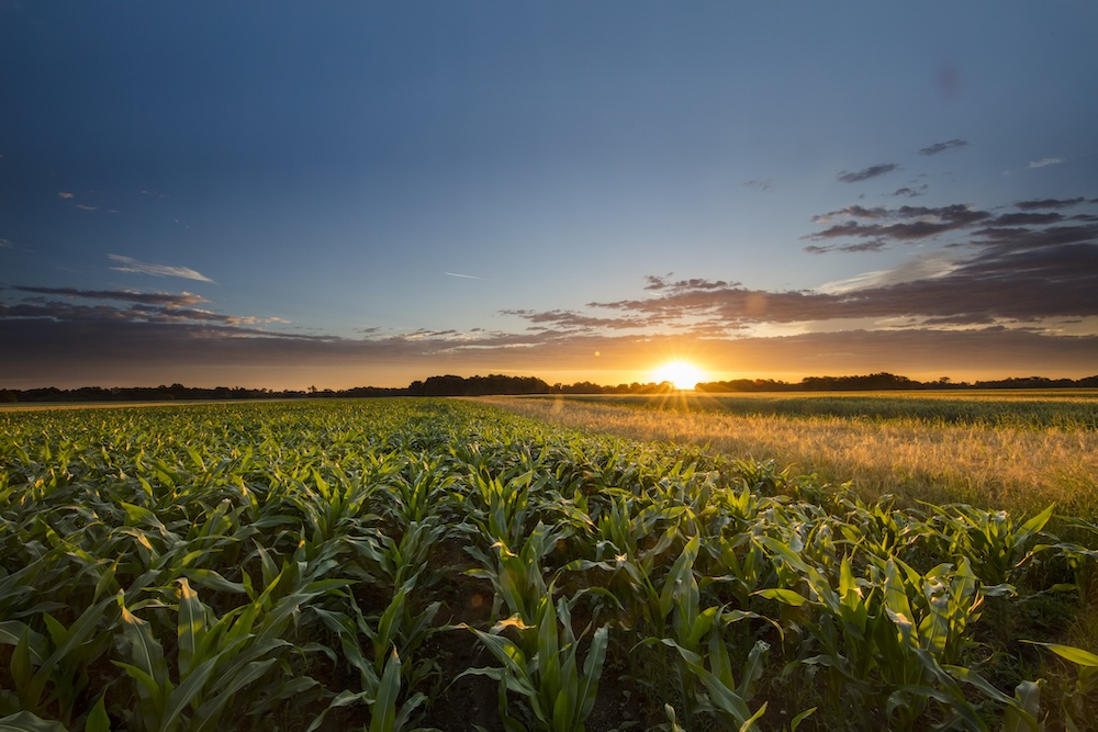
Throughout the state, dryland crops are doing poorly except where scattered showers happened to hit, while irrigated crops are taking all the water they could absorb.
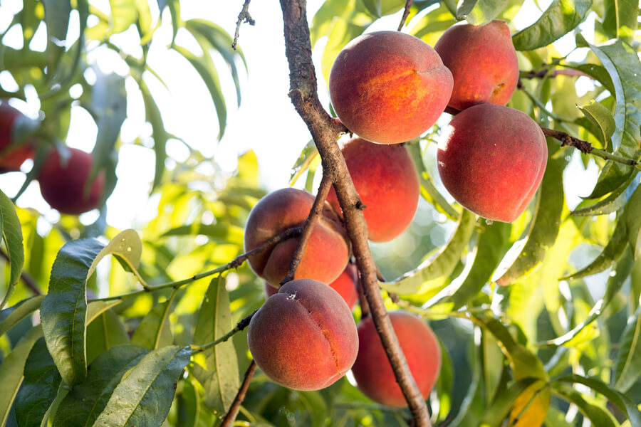
In north Georgia, the region that has had the longest stretch of drought, farmers are dealing with smaller-than-expected peaches due to the dry weather. Livestock producers in northern Georgia were feeding hay because the pastures were doing so poorly, and hay was being imported into the area from Tennessee to meet the demand. Some north Georgia corn farmers abandoned their crop due to the dry conditions.
One positive impact of the high heat is that irrigated cotton is maturing earlier than normal, which means farmers may be able to harvest in September rather than early October.
Climatologists expect August to start with scattered showers, but to return to drier-than-normal weather at the end of the month. Above-normal temperatures are likely to continue through October, and drier-than-normal conditions are slightly more likely than usual to continue as well.
Precipitation Totals
Almost half of Georgia has received less than 50 percent of its normal rainfall so far this summer.
Columbus, Georgia, recorded its driest July on record based on 115 years of data. Savannah, Georgia, was the second driest, based on 143 years of record, and Augusta and Brunswick, Georgia, were the third driest on record, according to each of those weather stations.
According to National Weather Service reports, Valdosta, Georgia, recorded the highest monthly total rainfall with 9.71 inches, 3.08 inches above normal. Columbus recorded the lowest with 0.96 inches, 3.80 inches below normal.
- Atlanta recorded 3.66 inches of rain, 1.61 inches below normal.
- Macon, Georgia, recorded 2.34 inches of rain, 2.61 inches below normal.
- Savannah recorded 1.21 inches of rain, 4.39 inches below normal.
- Augusta recorded 1.31 inches of rain, 3.02 inches below normal.
- Alma, Georgia, recorded 1.63 inches of rain, 3.70 inches below normal.
- Brunswick recorded 1.29 inches of rain, 2.79 inches below normal.
- Albany, Georgia, recorded 2.23 inches of rain, 3.23 inches below normal.
- Rome, Georgia, recorded 1.45 inches of rain, 2.87 inches below normal.
The highest single-day rainfall recorded by Community Collaborative Rain, Hail and Snow Network volunteers was 3.40 inches, measured northeast of Savannah in Chatham County, Georgia, on July 18, followed by 3.20 inches of rain south of Savannah on the same date.
A volunteer in Garfield, Georgia, in Emanuel County, reported 3.08 inches of rain on July 10. The highest monthly rainfall total, 9.27 inches, was measured east of Midway, Georgia, in Liberty County, followed by 8.31 inches of rain by a second volunteer nearby.
Temperatures
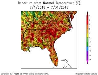
This summer has seen the second or third warmest June-to-July period on record for much of the state. Temperatures ranged from almost 2 to 3.5 degrees above the 1981–2010 average.
- In Atlanta, the monthly average temperature was 83.4 degrees Fahrenheit, 3.2 degrees above normal.
- Athens, Georgia, saw 84.0 F, 3.4 degrees above normal.
- Columbus saw 84.4 F, 1.9 degrees above normal.
- Macon saw 85.1 F, 3.3 degrees above normal.
- Savannah saw 86.1 F, 3.5 degrees above normal.
- Brunswick saw 85.5 F, 2.7 degrees above normal.
- Alma saw 84.4 F, 2.4 degrees above normal.
- Augusta saw 84.6 F, 3.0 degrees above normal.
- Albany saw 84.9 F, 2.5 degrees above normal.
- Rome saw 82.4 F, 2.8 degrees above normal.
In spite of the warm conditions, only one temperature record was set in July 2016. Alma reported a nighttime low temperature of 77 degrees on July 8, replacing the old high nighttime temperature of 76 degrees set in 2011. Alma and Brunswick also reported their warmest July temperatures on record, based on almost 70 years of data. Many other stations were in their top five warmest.
Severe weather was observed on 18 days during the month. Almost all of the reports involved scattered wind damage.
For more information, please see the “Climate and Agriculture in the South East” blog at blog.extension.uga.edu/climate/ or visit our webpage at gaclimate.org..Please feel free to email your weather and climate impacts on agriculture to share on the blog to pknox@uga.edu.