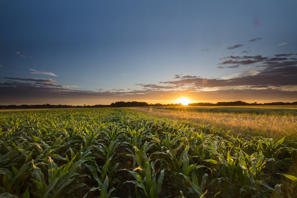
Wild variation in rainfall made 2014 a rough year for Georgia farmers, especially those in the southwestern corner of the state.
Abnormally heavy rainfall in April delayed necessary fieldwork and planting. Atypical dry conditions during the growing season stopped the germination of some seeds and put stress on many crops, leading to an increase in irrigation in some areas. When it was time to harvest, abnormally plentiful fall rain kept farmers out of their fields and reduced the yield and quality of some crops.
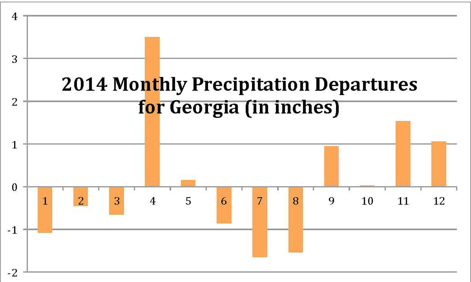
Precipitation
While April, September, November and December saw above-average rainfall across the state, the rest of 2014 left the state with just average or less-than-average precipitation levels. Conditions were the driest in June, July and August, attributable, at least in part, to the lack of tropical storms moving through the state this year. The tropical season was fairly quiet across the Atlantic Ocean basin, although it was very wet in the eastern Pacific Ocean, which is consistent with near-El Niño conditions that lingered through the summer and fall months.
By the end of August, about 25 percent of Georgia counties in the southwestern corner of the state were experiencing some level of drought, and about 20 counties were experiencing severe drought.
Heavy rains across the state, starting in September, helped to eliminate these drought and abnormally dry conditions and to recharge the state’s soil moisture for this growing season.
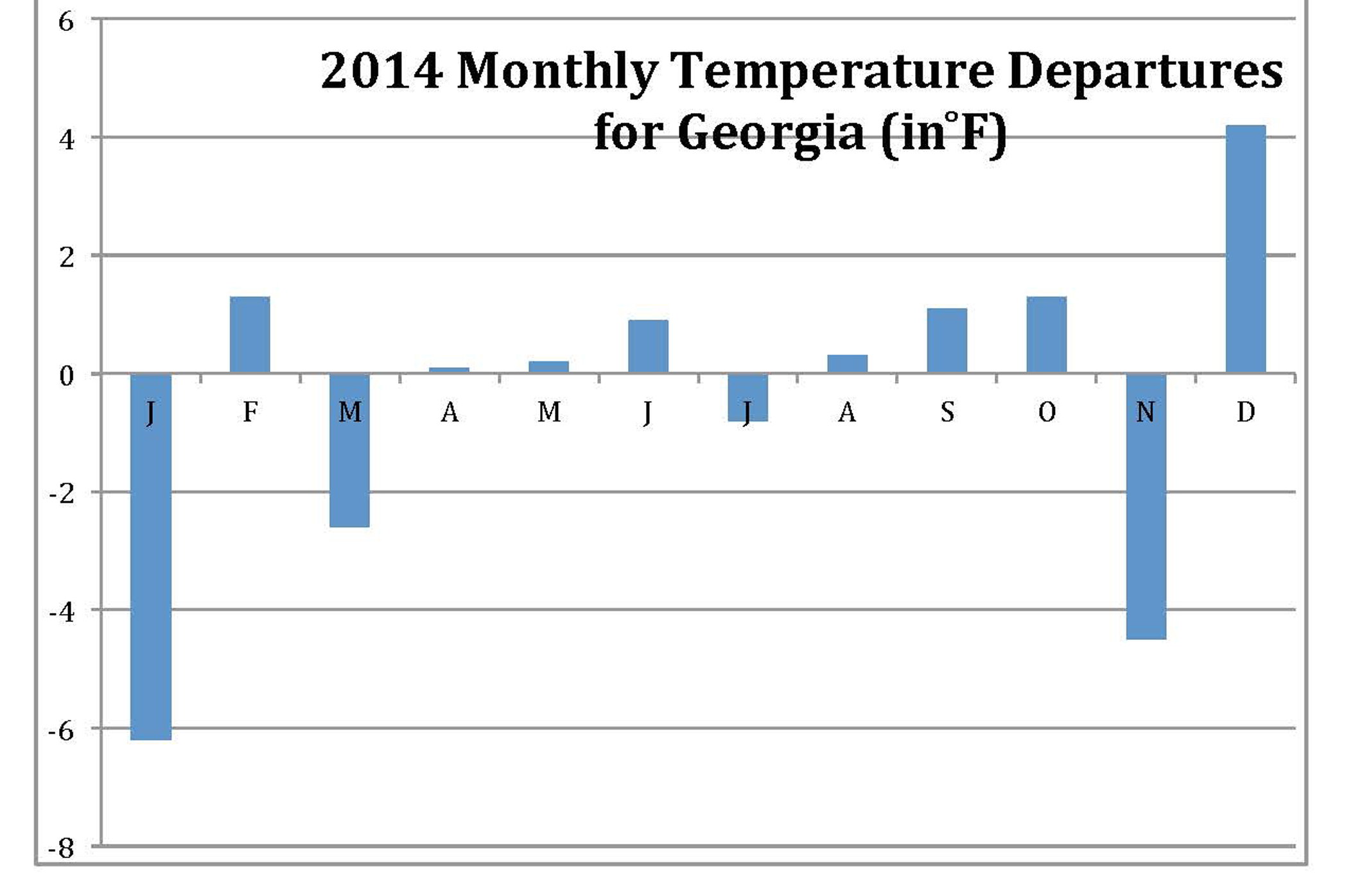
Temperature
The temperature departures for each month ranged from 6 degrees below normal in January to more than 4 degrees above normal in December, but, as a whole, 2014 will go down in the record books as one of the colder years in recent decades.
With the exception of two unusually cool periods in mid- and late-July, which made it feel more like October, farmers had a fairly normal growing season in the spring and summer. The first quarter of 2014 was colder than average and the last quarter was highly variable, with November being much colder and December being much warmer than average.
The large swings in winter and fall temperatures are related to the high-amplitude weather pattern that dominated the U.S. and the world for much of 2014. In this pattern, a ridge of high pressure developed in the western U.S., and a corresponding trough of low pressure dug into the eastern U.S. This pattern contributed to the continuation of drought in California and significantly above-normal temperatures in the west and Alaska. The same system helped keep the eastern U.S. relatively cool by comparison.
The eastern U.S., including Georgia, was one of the few areas on the globe with relatively cool temperatures this year. These cooler temperatures were one of the factors that prevented the dry conditions from turning into a crisis-level drought for the state. The only extended time period in Georgia’s history with no significant droughts was the period from about 1958 to 1980, when cool temperatures and some wet years resulted in a “benign period” during which there were no significant dry spells in the Southeast.
What to Expect in 2015
While climatologists were predicting an El Niño weather pattern in 2014, it never officially materialized. Many signs pointed to its presence, including the slow Atlantic hurricane season and very active eastern Pacific season.
At the end of 2014, warmer-than-normal ocean temperatures in the eastern Pacific Ocean were not quite high enough to officially declare an El Niño.
El Niño conditions are expected to be less of a concern going into 2015. Early predictions for next year indicate that the opposite pattern, La Niña, might develop by late in the year. Statistically, La Niña years generally have active tropical seasons and dry, warm winters. This could lead to a wetter-than-expected late summer and fall if the tropics bring storms across Georgia, and less winter recharge of soil moistures going into 2016.